
RiverMate – An Android App for River Levels

This free android app gives you the latest river level oberservations for rivers all over the United States. By selecting your state and/or county, you can select the rivers that you want to monitor. Add as many river gauges as you wish and they will be displayed and updated in real time on the app's main screen. This app is great for boaters, paddlers, kayakers, fishermen or anyone who needs to know the river levels in their local area. Best of all, it's free.
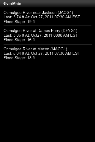
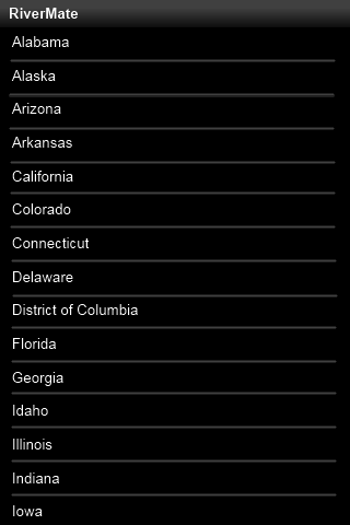
The National Oceanic and Atmospheric Administration (NOAA) provides the data used by the this android application. This data, managed by the National Weather Service, provides a real-time update of all the rivers in the united states. After selecting you state or county you will see an entry from every river in that geographical area. This android app will tell you which river gauge was used and you may see more than one for each river. In addition, you will be shown when the measurement occured, the river depth, and what the flood stage depth is.
This app is free and simple to use. It only has two screens – one to select the region and one to show the measurements. See the easy to use screens below.
 |
 |
Go to the android marketplace to get this free android app to monitor river levels or use the QR code below:

Feel free to leave a comment below. I would like to hear suggests or critiques.
You must belogged in to post a comment.
Add graphs of flow and gauge height as on usga web. It is nice to know if rivers levels are trending up or down as well as what the immediate values are.